Weather

Weather Conditions at New millennium Obs.
Meteo data live from the weather station located in the New Millennium Observatory park very near the dome.
The weather station data are courtesy of Dott. Ing. Luca Cozzi and Centro Meteo Lombardo.
Meteosat Receiver
A "Dream is Alive" Satellite!
At the beginning of 2005, I received the authorization to access the Meteosat Second Generation (MSG-1) satellite data.
This satellite is managed by EuMetSat and takes a picture of our Planet every 15 minutes in 12 spectra channels covering the visible, infrared (near and far) and water vapor bands.
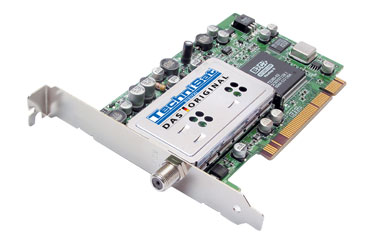
My system comprises a 90-cm parabolic antenna with a common LNB for satellite TV receiving, a TechniSat SkyStar2 PCI card, the software and the USB key provided by EuMetSat.
To manage the huge amount of data (more than 10Gb/day!) I use MSG Data Manager by David Taylor. It works very well and it is able to really boost toward the stars the performance of the system.
For a deeper management of the images and for a very nice color mix of the image I use GeoSatSignal by David Taylor.
Due to an agreement with EuMetSat
I can not rebroadcast the data received by EuMetSat, and all
the following images are Copyright by
![]()


Polar Satellites
|
I have also installed a system to receive the polar satellites (NOAA12, NOAA14, NOAA15 and NOAA17). The system was very nice and useful just before the MSG-1 authorization, because the resolution of polar satellites was better than Meteosat 7, now, with MSG-1 (see previous section) I use these satellites only for didactic and technology purposes. The hardware is represented by an helicoidal antenna, a small and very simple receiver on 137MHz frequency and a software to manage the data collected by receiver. The manufacturer of the system is Roberto Fontana Software. Given that the satellites broadcast a characteristic sound, it is very nice to listen to the receiver and track the satellite with the telescope. The ParamountME is able to catch and track the satellite when it is above Southern Mediterranean Sea and follows it until over Scandinavian Region. |
Weather Station
Another fundamental instruments to monitor the weather condition in the observatory region is a weather station that collects meteo data continuously; in particular, for astronomy, it is fundamental to keep under control the temperature, the atmospheric pressure, relative humidity and the dew point.
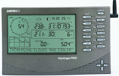
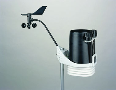
My weather station is a Davis Vantage Pro with temperature, humidity, pressure and rain sensors. In spite of a serious problem in tuning the rain collector in the first months of use, now it works very well.
On the right there is an example of real time data collected by the Vantage Pro.


Weather Statistics
f you want to browse the data archive, please find here following the links to Mozzate weather data yearly and monthly grouped. These data are property of Dott. Ing. Luca Cozzi and can be used only for non-commercial purpose. The property must be always indicated.
2003-05


